
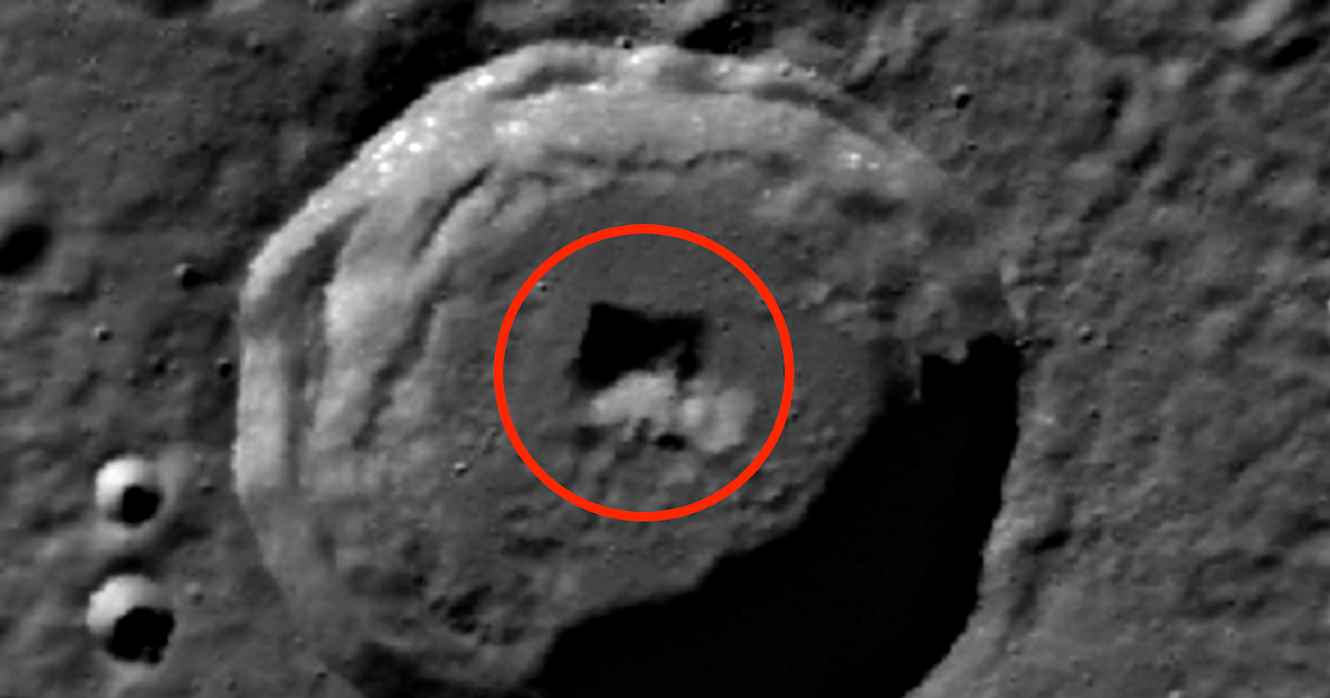
Source-provided UFO Sightings Daily screenshot of the Mercury map feature; the image is evidence of the feature being highlighted by the source, not evidence of an artificial entrance.
The short version
- UFO Sightings Daily says the discovery date was August 17, 2026 and identifies the location as Planet Mercury using a Mercury Quickmap link.
- The source describes a square-looking feature near the center of a crater and says it measured about 5 km by 5 km using the map ruler.
- The source’s leap from square-looking terrain to an underground alien base is not supported by the screenshot or source text alone, so this article preserves the lead while separating the measurement claim from interpretation.
What the report says
The post states that the author was searching a Mercury map when a square-shaped feature in a crater caught his attention. It gives a Mercury Quickmap URL and describes three visible sides of the feature.
The concrete details are limited: discovery date, planet, source map URL, screenshots, and a claimed 5 km by 5 km measurement. Those are enough to preserve the lead for image-context review.
The article’s stronger language about spaceships, alien bases, radiation protection, and long-lived species is presented as the source author’s speculation. The available material does not establish artificial origin, scale certainty, or any connection to life.
Media and records limits
The source image is a cropped screenshot, not a peer-reviewed planetary-geology analysis. Shape, shadow, viewing angle, compression, crater wall geometry, and map-layer processing all need to be checked before any conclusion is drawn.
This item was not added to the Earth sightings map because the claimed feature is on Mercury. It belongs in the monitor as a source-image lead, not as a terrestrial sighting pin.
Why this one is worth tracking
Non-Earth image claims can be noisy, but they also provide a useful test of the monitor’s standard: preserve the exact source and image trail without amplifying unsupported conclusions.
The Mercury Quickmap link gives future reviewers a path to revisit the original terrain context, compare alternate layers, and decide whether the “square” appearance persists outside the cropped screenshots.
Open questions
- Does the square-looking feature remain visible in alternate Mercury map layers, lighting geometries, or source-image products?
- Can the claimed 5 km measurement be reproduced from the Quickmap URL and scale tools?
- Is the feature better explained by crater morphology, shadowing, image seams, or compression artifacts?