
Mars ESRI face-like feature lead enters source-image review
A UFO Sightings Daily post points readers to an ESRI Mars map and a source image it interprets as a face-like formation; The UAP Trail tracks the concrete image claim separately from the alien-culture conclusions.
The short version
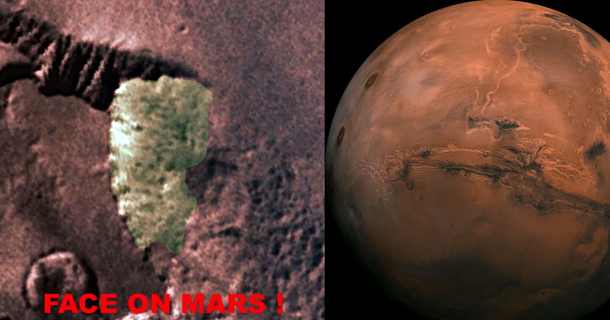
UFO Sightings Daily published a Sept. 11 source-image lead saying the author found a face-like formation while using an ESRI Mars map. The concrete lead is narrow: a source map, a Mars location described only through the linked map/video walkthrough, and a source-provided screenshot. The article's claims about ancient aliens, Naga traditions, or intentional sculpture are interpretations, not verified evidence.
What the report says
The source post lists the discovery date as Sept. 11, 2026, the location as Mars, and the source map as ESRI's Explore Mars map. The author says coordinates were not provided because he had only recently begun using the map, and directs readers to the accompanying video to relocate the feature.
The post describes a face-like shape with apparent nose, eye, lips, chin, ears, and a turban-like upper outline. It then argues that the feature resembles Earth religious or cultural imagery. Those cultural and alien-origin claims are source speculation; they do not establish artificial construction.
Media analysis and limits
The source image is useful as a lead because it shows the exact visual claim being circulated. It is not a measurement, a peer-reviewed geomorphology analysis, or proof that the formation is artificial. Mars imagery routinely produces pareidolia: terrain, shadows, compression, and angle can combine into face-like shapes. A real review would need coordinates, original map layer metadata, lighting geometry, and comparison imagery from the same feature.
Why this one is worth tracking
Non-Earth image claims often spread quickly and can be mistaken for direct evidence. Keeping this item in the monitor lets readers see the source image, the map trail, and the limits in one place without converting a speculative interpretation into a conclusion.
Open questions
- What exact ESRI Mars map coordinates or layer identifiers correspond to the feature?
- Can the same feature be matched to an original NASA or mission image product?
- Does the face-like appearance persist under alternate lighting, scale, or source imagery?
- Is the circulating screenshot cropped, sharpened, or color-adjusted beyond the map view?