
California offshore seabed-image lead: claimed pyramid feature gets source review
A UFO Sightings Daily source-image lead points to a Seabed 2030 bathymetry feature off the California coast; The UAP Trail separates the coordinates and map claim from unsupported alien-base conclusions.
The short version
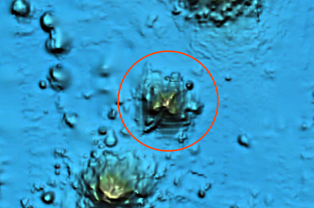
- UFO Sightings Daily posted the lead on Sept. 6, 2026 and described a layered, roughly 15-by-15-mile seabed feature found on the Seabed 2030 map.
- The source gives coordinates at 32°19'22.71"N, 127°8'7.95"W, west of the California coast.
- The article claims Google Earth blurs the same area and interprets the feature as an alien pyramid/base; those conclusions are not demonstrated by the source image alone.
What the report appears to explain
The report says the discovery came from reviewing Seabed 2030 bathymetry imagery after the author found Google Earth ocean-floor detail too limited. It identifies a broad geometric-looking feature offshore from California and describes it as layered, pyramid-like, and around 15 miles across. The concrete source facts are the posted coordinates, the Seabed 2030 map reference, the still images, and the embedded video walkthrough. The claim that Google intentionally hid the area, or that the feature is an occupied alien structure, remains unsupported in the material reviewed here.
Media and records limits
This is a source-image lead, not a witness event or an official identification. Bathymetry rendering, map resolution, smoothing, seam artifacts, and natural seabed geology all have to be checked before the shape can carry evidentiary weight. The embedded source video is useful for reconstructing what the source saw, but it does not substitute for original bathymetric metadata or independent geologic review.
Why this one is worth tracking
It is worth tracking because it provides coordinates and a specific map source rather than only a viral image. That makes the claim testable: reviewers can compare Seabed 2030, Google Earth, nautical charts, and bathymetric datasets for the same point instead of debating a context-free screenshot.
Open questions
- Does the Seabed 2030 layer at the listed coordinates show the same geometry at multiple zoom levels and data products?
- Which survey contributed the bathymetry tile, and what resolution/smoothing was applied?
- Can marine geology or map-tile processing explain the apparent edges and layering?
- Does Google Earth actually suppress unique source detail at this point, or is the difference a normal dataset/resolution mismatch?
Sources
- UFO Sightings Daily source post — posted Sept. 6, 2026.
- Seabed 2030 map project — source map named by the post.