
Australia offshore seabed-image lead: claimed ten-mile structure needs bathymetry review
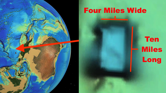
A UFO Sightings Daily source-image lead points to a Seabed 2030 feature described as a ten-mile structure below Australia; the article preserves the map facts while separating them from unsupported alien-base claims.
The short version
- UFO Sightings Daily posted the lead on Sept. 8, 2026 and described a Seabed 2030 ocean-floor feature below Australia.
- The source characterizes the feature as about ten miles by four miles and speculates that it extends much deeper below the visible map surface.
- The source does not provide coordinates in the text recovered for this review; the alien-base and occupancy claims are unsupported by the available map screenshots and video alone.
What the report appears to explain
The report says the author found a large, clean-looking ocean-floor feature while reviewing Seabed 2030 imagery below Australia. It describes the alleged structure as roughly ten miles long and four miles wide, and it pairs that description with still images and an embedded source video. The concrete material is a source post, a map-source reference, and imagery from the post. The leap from unusual map geometry to an occupied alien base is the source author’s interpretation, not an independently verified finding.
Media and records limits
The useful evidence is limited by the absence of coordinates in the recovered source text and by the nature of rendered bathymetry imagery. Without exact coordinates, survey provenance, scale confirmation, and comparison against other seabed datasets, the feature should be treated as a map-review lead rather than a confirmed structure. The source video can help locate the feature if it shows map navigation, but it still requires external confirmation.
Why this one is worth tracking
It is worth tracking because it continues a run of Seabed 2030-based claims that can be checked against primary map data. The lack of coordinates is itself important: before this lead can move beyond archive watch, reviewers need a reproducible location.
Open questions
- What exact coordinates does the source video show for the claimed feature?
- Does the same geometry appear in other bathymetry products, nautical charts, or raw survey grids?
- Could survey-track seams, interpolation, shadows, or rendering settings explain the apparent clean edges?
- Can the scale claim of ten by four miles be reproduced from the map interface?
Sources
- UFO Sightings Daily source post — posted Sept. 8, 2026.
- Seabed 2030 map project — source map named by the post.