
The short version
- The source says the feature was found on Google Earth and locates it broadly in Antarctica.
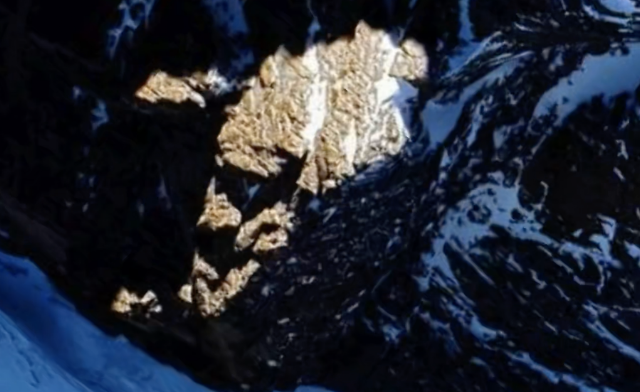
- The post argues that an island or landform resembles a face under favorable sunlight and shadow.
- No coordinates, field evidence, survey data, or independent expert assessment were available in the source page during this run.
What the report says
The source page describes the item as an August 1, 2026 discovery in Antarctica using Google Earth imagery. The author says the feature looks like a face and attributes the shape to alien makers.
The concrete facts available are narrower: there is a map/image lead, a broad Antarctica location, and a visual resemblance claim. The alien-artifact conclusion is unsupported by the source material provided.
Media and records limits
The source image is a screenshot, so it is sensitive to viewing angle, shadow, terrain relief, compression, and human pattern recognition. Without coordinates, alternate dates, raw imagery, and topographic data, the claim cannot be tested from the screenshot alone.
This article treats the item as a media-literacy and source-monitor entry rather than a verified sighting report.
Why this one is worth tracking
- It shows how Google Earth anomaly claims enter the UAP news stream.
- It gives readers a clean separation between a visible resemblance and a conclusion about non-human construction.
- If coordinates emerge, the feature can be checked against terrain layers, imagery dates, and geologic context.
Open questions
- What are the exact Google Earth coordinates and imagery date?
- Does the feature persist across satellite passes, seasons, and sun angles?
- Can topographic or geologic data explain the face-like appearance without invoking an artificial origin?